As an urban planner in Kenya, I’ve participated in many planning processes. They usually begin in neat boardrooms, with maps, policy reviews, and stakeholder workshops.
Homa Bay, on the shores of beautiful Lake Victoria, was different.
Here, planning started not with a grand ceremony or boardroom meeting, but with quiet steps and shared curiosity. With conversations and unlikely partnerships formed on vibrant footpaths, bustling beaches, and boat landings where life and climate risk are experienced daily. In people’s homes, and in the informal settlements of Shauri Yako, Makongeni, Sofia. Even farther—on Remba Island, Ringiti Island, and 1000 Street in Oyugis municipality.
The county government, Akiba Mashinani Trust (AMT), the Global Centre on Adaptation (GCA), and local leaders all played a role in initiating the process of developing a climate-resilient land use plan. But what truly shaped the plan was the residents themselves.
When the Community Became the Researchers
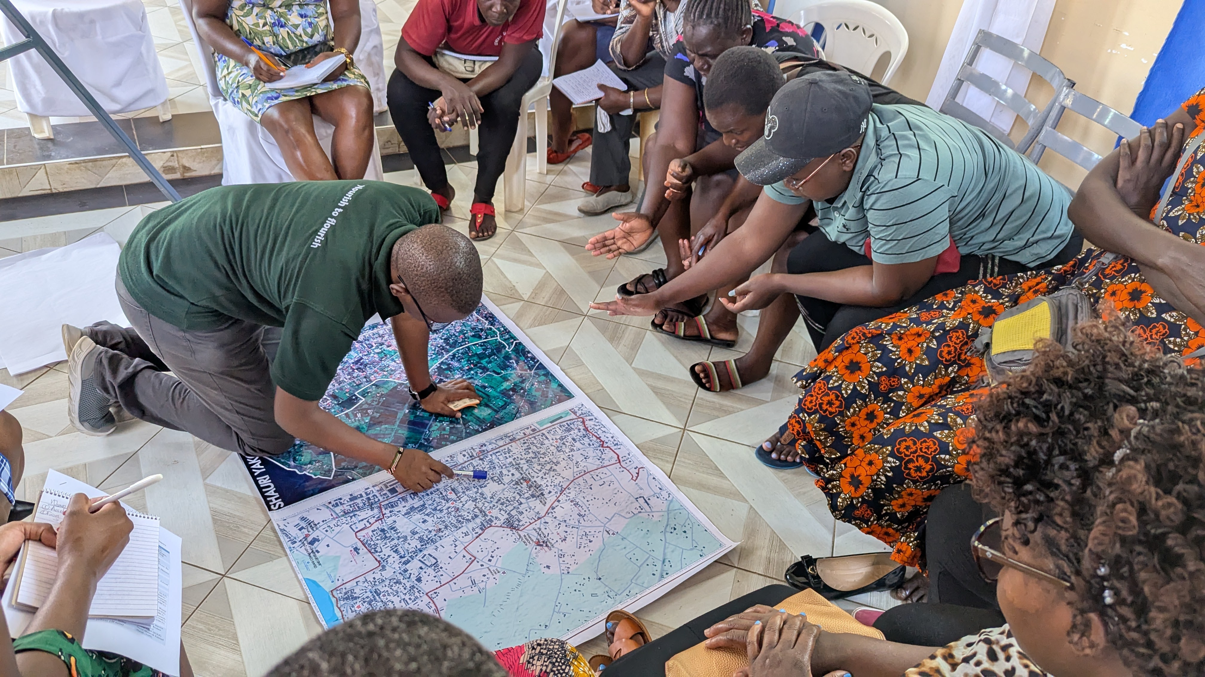
One of the most inspiring parts of the process was watching over 300 community co-researchers, young people from the County, take leadership. Trained by AMT and Tom Mboya University, they went door to door, speaking to families, listening to stories, and quite literally redrawing their future.
Families told their stories, describing their struggles, hopes and aspirations. People participated because it was the first time they felt a plan was being shaped by their voices, not by their signatures on attendance sheets. It was the first time they felt a development process was happening with them, not to them.
The more the team listened, the more the plan grew into something bigger than a technical exercise. It became a mirror of the people’s priorities, anchored in real experiences. The data the team gathered shed light on aspects that are often invisible even to neighbors. Which family suffers most when the taps run dry, the Lake yields less fish, or the neighborhood floods.
As the days passed, I realized we were not just witnessing the birth of a climate-resilient land use plan—we were witnessing a community defining its future in an uncertain world.
Teamwork that Redefined Collaboration
Teamwork was the thread that held everything together. I witnessed roles shifting fluidly, government departments blending, and sometimes the work demanding flexibility that stretched everyone. But what made the journey manageable was the willingness of team members to step in and support one another, no matter where they came from.
County officials, AMT staff, students and lecturers from Tom Mboya University, and Community co-researchers all found themselves working as one seamless and integrated unit. When challenges arose—be it tense moments during community meetings, logistical hurdles, or exhausted team members—someone always stepped in with clarity, encouragement, or solutions. From a reflection meeting held in Homa Bay many recalled late-night calls to align maps, early morning field check-ins, and impromptu planning sessions that felt more like family conversations than official work.
This unity created a bond that carried the entire process. The group learned to trust one another, to lean on each other’s strengths, and to treat every obstacle as a shared problem. By the time the plan was completed, we were no longer just a team—we were a community of practice.
A Living Classroom
For most of the people involved, this journey became a living classroom as opposed to the normal planning process where professionals are rigid and come with polished tools and processes. Every day brought new learning, whether in the field or at the office. Young community co-researchers, many of whom had never used GPS mapping tools or conducted a structured interview, were trained and suddenly found themselves leading data collection across multiple settlements.
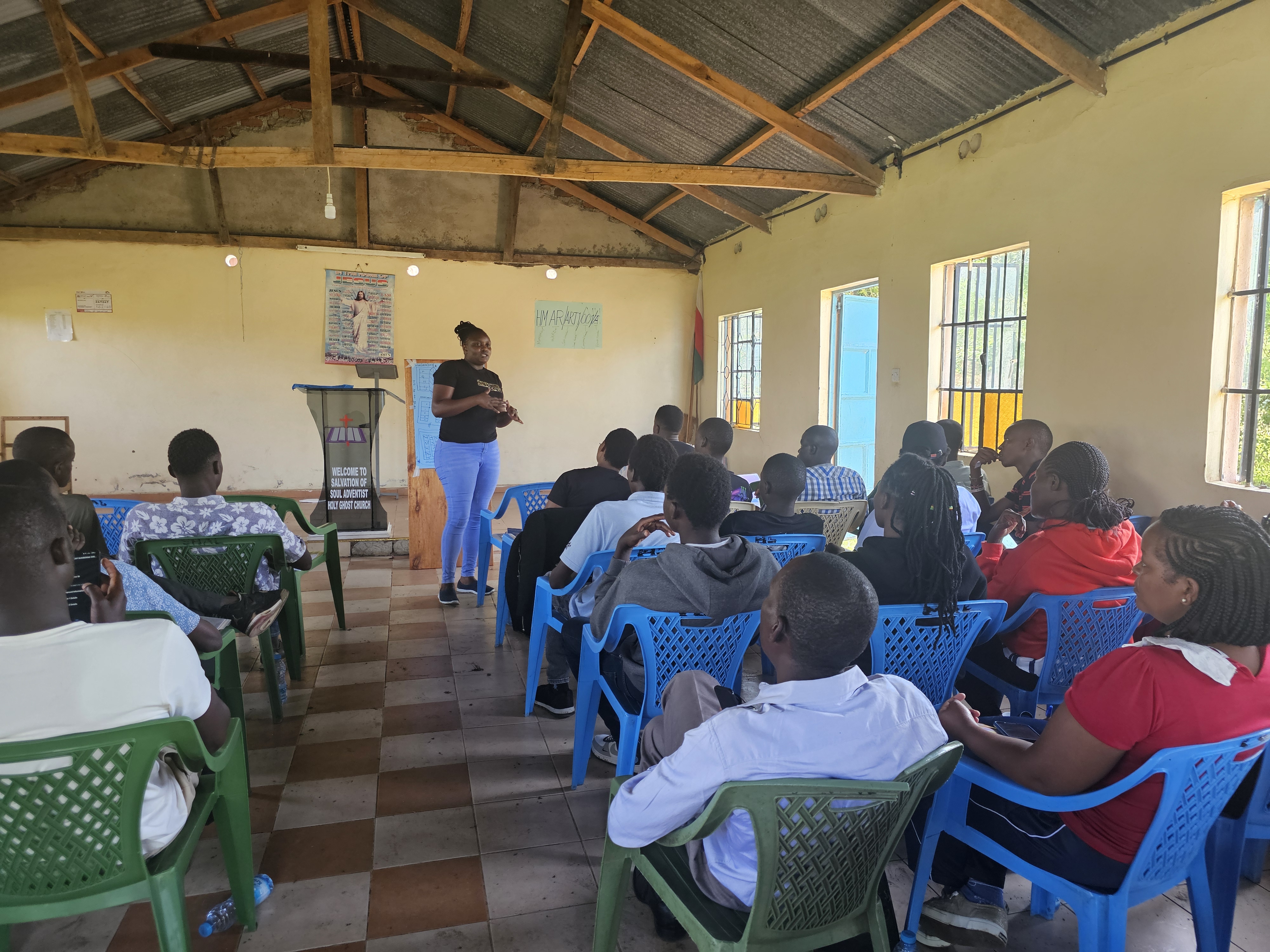
University students received hands-on experience that textbooks only hint at. AMT youth planners became lecturers at Tom Mboya University to teach GIS mapping to third year geographers.
County officers learned about zoning laws, spatial thinking, climate risk assessment, and mapping standards.
AMT’s young planners found themselves teaching and learning in equal measure, navigating between technical rigor and community realities. Even seasoned planners admitted that the process sharpened skills they didn’t know they needed.
Along the way, the team travelled—sometimes on foot, sometimes by motorbike, and sometimes across the vast waters of Lake Victoria. We met new faces, discovered different neighborhoods, and challenged our own assumptions about urban life. Everything felt like a lesson, and everyone grew from it.
Crossing the Water: Lessons from the Islands
Perhaps the most unforgettable part of the journey was the travel to Remba and Ringiti Islands. The team braved long, unpredictable boat rides—some smooth, some frightening, especially the moment a boat stalled in the middle of the lake. But once we reached the islands, we found communities with resilience carved into their daily existence.
Life on the islands offered us a different perspective on adaptation and development. The narrow spaces, makeshift structures, dense populations, and daily struggles showed the urgency for planning that considers climate exposure, mobility, safety, and dignity.
These visits became defining moments for us—moments that broadened our understanding of Homa Bay and reinforced the commitment to include the islands meaningfully in future planning efforts. We left with memories of courageous fishermen, hardworking women, curious children, and stunning lake views that contrasted sharply with the harshness of island life.
A Model that Attracted National Attention
As the plan took shape, word began to spread beyond Homa Bay. Professionals from across the country reached out, asking “what is this People’s Adaptation Plan”. They were drawn to its unusual blend of statutory planning and deep community-driven insights.
This was because the process was unusual: a level of public participation, mapping detail, lived reality data, and community consultation which is rarely seen in municipal planning processes. Instead of being built through technical assumptions, it was shaped through lived realities, daily struggles, and community dreams.
The plan became a model—one that other counties could look to, not only for content but for process. For the team, this recognition was both humbling and affirming. It meant that the months of hard work, field visits, and long nights had produced something of national significance.
Moments That Shaped the Journey
What will stay with the team long after the plan is launched are the small, personal moments that turned colleagues into companions. We shared meals after exhausting field days, laughter sparked by logistical mishaps, jokes exchanged during late-night mapping marathons and writeshops, and words of encouragement passed around when spirits dipped.
There were moments of fear—especially on the lake—but also moments of awe as we discovered parts of Kenya we had never seen. Some team members formed friendships so deep they still call one another for guidance or just to check in.
And there were moments with communities that moved us deeply: a grandmother expressing gratitude for planners sitting on her doorstep to listen to her ideas. Young people described their dream for a better future, and other residents said, “This time, the plan feels like ours.”
These moments stitched the journey together in ways that no official report can fully capture. This also reminded me that planning is not just technical but really relational.
Political Goodwill – A rare Ingredient
Unlike conventional planning projects which are slowed by bureaucracy, behind the scenes, the work was powered by strong political backing. From the Governor to the municipal board, from the County Secretary to county assembly committees, from County Executive Committee members to chief officers and directors, leaders stood behind the process. They offered direction, opened doors, cleared barriers, and ensured the plan aligned with county priorities.
This goodwill created the enabling environment that many planning processes lack. It kept the team going when complex decisions had to be made, when setbacks occurred, or when coordination became difficult. It made the team believe that the plan would not just be written—it would be championed.
From Planning to Transformation
As the plan enters the stage of approval and adoption, the team carries one hope—the hope of implementation. We look forward to seeing zoning regulations guide development, quick wins taking shape in water and sanitation, lakefront improvement projects aligning with the plan, and community benefits flowing from initiatives such as AFDB-supported initiative.
We also hope that the islands will eventually receive their dedicated plans, and that similar approaches will expand to other municipalities across the county.
For the team, implementation is not just a technical step—it is the fulfilment of a promise made to the people who shared their stories, dreams, and vulnerabilities with us.